
File:AfricaLocation.svg

Size of this PNG preview of this SVG file: pikseelii 463 × 236. Kabiraa furmaatawwan: pikseelii 320 × 163 | pikseelii 640 × 326 | pikseelii 1,024 × 522 | pikseelii 1,280 × 652 | pikseelii 2,560 × 1,305.
Faayila abbaa (SVG file, nominally 463 × 236 pixels, file size: 290 KB)
Guduunfaa
| Ibsa |
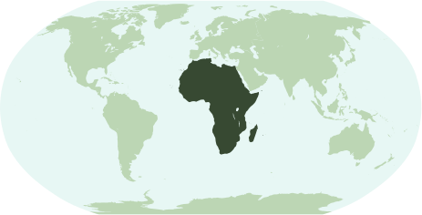
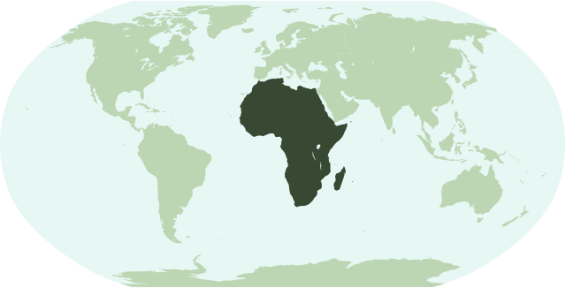
English: Map showing the location of the continent of Africa (including indian ocean islands near Madagascar).
Français : Une carte pour démontrer la location du continent de l'Afrique (avec des îles d'océan indien près de Madagasque).
Interlingua: Un Mapa monstrante le location del continente de Africa (con insulas del oceano indian juxta Madagascar). |
| Guyyaa | |
| Lakkaddaa | Hojii ofii |
| Barreessaa | Notscott |
Eeyyamsiisuu
| I, the copyright holder of this work, release this work into the public domain. This applies worldwide. In some countries this may not be legally possible; if so: I grant anyone the right to use this work for any purpose, without any conditions, unless such conditions are required by law. |
Seenaa faayilaa
Faayilicha sa'aa san akka itti mul'atetti ilaaluuf guyyaa/yeroo cuqaasi.
| Guyyaa/Sa'aa | Qeensa abgudduu | Kallattiiwwan | Fayyadamaa | Yaada | |
|---|---|---|---|---|---|
| amma | 01:23, 15 Amajjii 2007 | | 463 × 236 (290 KB) | Notscott | {{en|Map showing the location of the continent of Africa (including indian ocean islands near Madagascar).}} {{fr|Une carte pour démontrer la location du continent de l'Afrique (avec des îles d'océan indien près de Madagasque).}} {{ia|Un Mapa monstran |
| 23:50, 14 Amajjii 2007 |  | 463 × 236 (290 KB) | Notscott | {{en|Map showing the location of the continent of Africa (including indian ocean islands near Madagascar).}} {{fr|Une carte pour démontrer la location du continent d'Afrique (avec des îles d'océan indien près de Madagasque).}} {{ia|Un Mapa monstrante |
Fayyadamiinsa faayilaa
Kutaan itti anuu "file"ii kanan walitti qabatta:
Fayyadamiinsa faayila guutu addunyaa
Wikileen biroo kan armaan gadi jiran fayila kana fayyadamu:
- Fayyadamiinsa arz.wikipedia.org irratti
- جنوب السودان
- ليبيا
- مصر
- جمهورية كونجو الديموقراطيه
- زيمبابوى
- اسواتينى
- سينيجال
- رواندا
- اوجاندا
- ثيويتا
- الجزاير
- سانت هيلينا
- قالب:افريقيا
- قالب:امريكا الجنوبية/شرح
- قالب:شرح استعمال قوالب القارات
- اريتريا
- شمال افريقيا
- شرق افريقيا
- وسط افريقيا
- كوت ديفوار
- جيبوتى
- بوركينا فاسو
- بوتسوانا
- افريقيا الوسطى
- الاحزاب السياسية فى تونس
- الاحزاب السياسية فى جنوب السودان
- الاحزاب السياسية فى السودان
- الاحزاب السياسيه فى المغرب
- جمهورية الكونجو
- جينيا
- جامبيا
- لغات مصر
- قالب:الاحزاب السياسيه فى دول افريقيا
- قالب:اناشيد دول افريقيا الوطنيه
- قالب:جامعات افريقيا
- Fayyadamiinsa avk.wikipedia.org irratti
- Fayyadamiinsa bi.wikipedia.org irratti
- Fayyadamiinsa bm.wikipedia.org irratti
- Fayyadamiinsa bpy.wikipedia.org irratti
- Fayyadamiinsa cbk-zam.wikipedia.org irratti
- Fayyadamiinsa ch.wikipedia.org irratti
- Fayyadamiinsa en.wikipedia.org irratti
Mul'isa fayyadama duniyaalessa edaasaa harshama kanaa.